A Kumu use case by Maria Balcazar Tellez & Alexis Rife of Meridian Institute.
Nothing gets us more excited than seeing the endless number of ways in which our customers are using Kumu. Especially when our tool is used to make a positive impact and create lasting change!
In this blog post, we explore how Meridian Institute leveraged Kumu to create a powerful network map that:
-
-
- Visually represents the worldwide relationships among stakeholders involved in food system efforts; and
- Gathers insights on opportunities and gaps in the system to define focus and drive resources for maximum collective impact
-
Let’s dive in!
About Meridian Institute
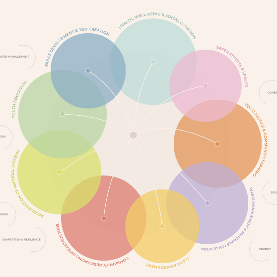
Meridian Institute is a non-profit consultancy that works with diverse stakeholders to build understanding, guide collaboration, and drive action around challenging environmental issues. Meridian brings people together to find common ground and drive action by establishing partnerships, building coalitions, and providing foundational support for long-term collaboration. One major body of work for Meridian is food systems — both land and water based.
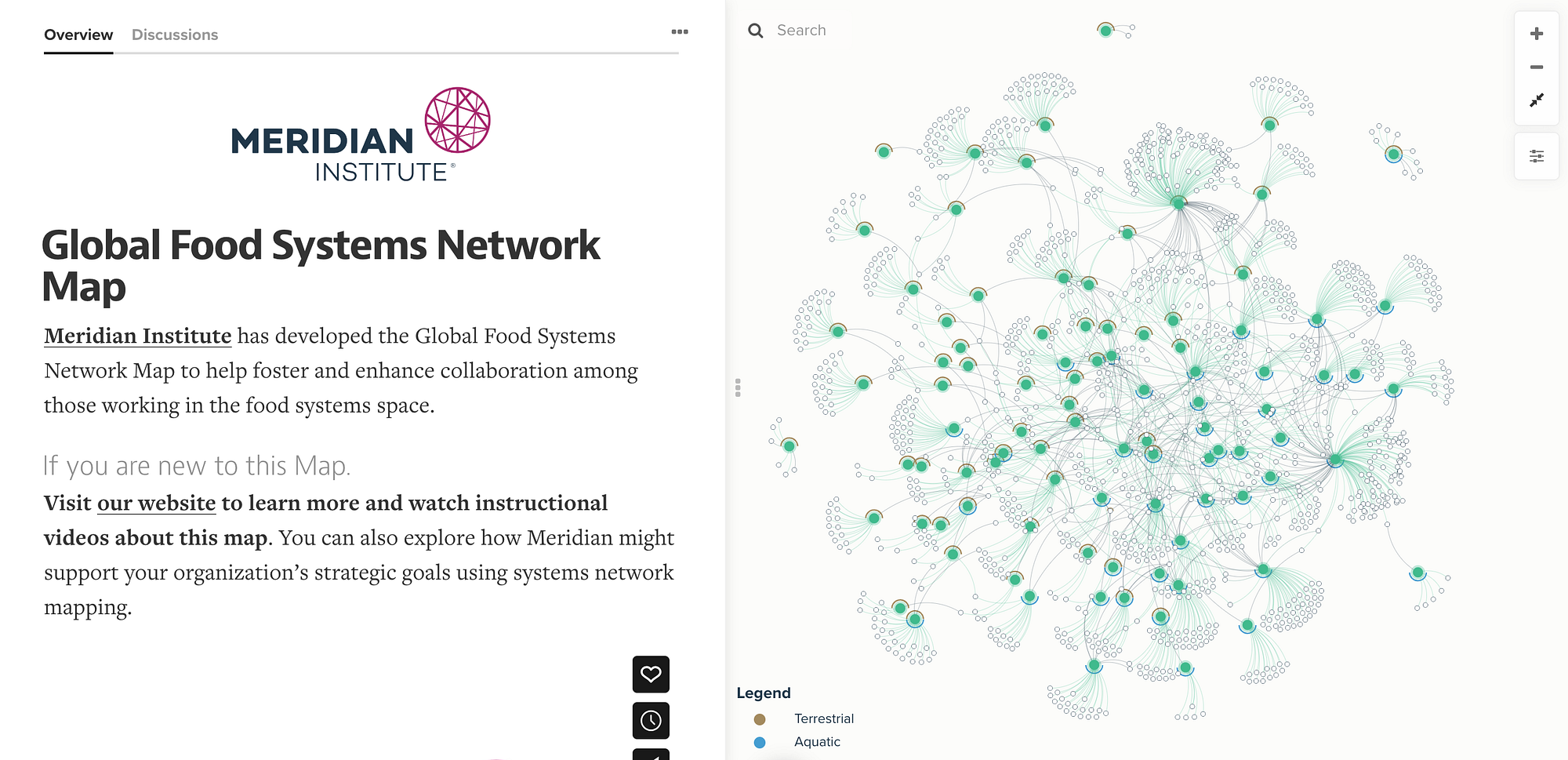
Meridian Institute saw the proliferation of efforts working on food in recent years and developed the Global Food Systems Network Map to help foster and enhance collaboration among those working in the food systems space. The Network Map aims to empower organizations and funding institutions to optimize their investments and efforts.
“The Global Food Systems Network Map can be used by anyone to help make sense of the global food systems landscape — and can help decision-makers determine where to allocate resources and efforts to maximize positive environmental and social impact.
The proliferation of initiatives and organizations in the food systems space is great to see, but it has resulted in a landscape of piecewise, potentially duplicative efforts. Our hope is that this interactive map will help individuals and institutions in the space complement each other and forge new partnerships.” — Todd Barker, CEO of Meridian Institute.
Making the Global Food Systems Network Map
Co-led by Maria Balcazar Tellez and Alexis Rife, the Meridian team used Kumu to build out the Global Food Systems Network Map. The map visually represents the complex web of relationships among stakeholders and visualizes a series of system network maps, focusing on system drivers, stakeholder relationships, and different topics within the global food system.
Through the use of controls, the map design allows you to dynamically view data, filter relevant elements, and gain insights tailored to your interest. It was publicly released in October 2023.
Network Map Capabilities
The Global Food Systems Network Map provides valuable insights into multi-stakeholder food system initiatives, to explore questions such as:
- What are initiatives working on?
- Who is involved in these initiatives?
- How are these initiatives bringing about change?
- Where are there opportunities for learning and collaboration?
- Which areas of the food system have varying levels of initiative engagement?
Mapping in Kumu helped the Meridian team establish a robust foundation for stakeholders, enhancing their ability to execute their work effectively, by tracking their efforts across the food system and discovering how others are approaching this work. The tool also supports decision-makers on resource allocation to maximize positive environmental and social impact.
Additionally, users can visualize existing connections between institutions, multi-stakeholder initiatives, and funders, which helps in identifying areas where efforts are concentrated and reveals systemic gaps that require attention.
Learnings from the network map
Though the mapping is an ongoing process, fascinating insights have emerged from this data visualization’s first stages. One notable finding from the map is the distributed and collaborative nature of the global food-systems network–there is no one “power hoarder” or institution with disproportionate influence across the network. Instead, widespread knowledge-sharing and cooperation are prevalent among initiatives.
Nonetheless, Meridian’s analysis identified four specific areas for further exploration and potential improvement, where increased collaboration could drive meaningful change:
- Alternative protein consumption
- Forestry and forest carbon
- Water resource management
- Forced labor
Meridian emphasizes that the Global Food Systems Network Map is an evolving project, with ongoing updates and improvements based on stakeholder feedback. The iteration released in October 2023 is based on preliminary data gathering and should not be viewed as a complete and final view of every multi-stakeholder initiative actively working in food systems.
How can you contribute?
The Global Food Systems Network Map is a first step in improving the constantly changing landscape of terrestrial and aquatic food systems. As Meridian continues to add to the database, they welcome anyone’s input to support their work.
Do you know of anyone, or are you, involved in a multi-stakeholder food system initiative that should be included in the map? Make sure to reach out to Meridian Institute through this form to contribute. Insights from stakeholders are invaluable as Meridian strives to make the network map a more comprehensive and useful resource for all.
A food system that nourishes both people and planet
The Global Food Systems Network Map represents a significant step forward in collective efforts to transform the food system. By visualizing connections, identifying opportunities, and fostering collaboration, it empowers stakeholders to drive positive change and build a more sustainable future for all.
Let’s harness the power of connectivity to create a food system that sustains us all — humans and the planet alike! Together, we can drive positive change through collaboration and informed action.
For more information, please visit foodsystemsmap.merid.org.
Discover more
Intrigued to see more by Meridian Institute? Check out this Climate-Smart Commodities Network Map, an interactive Kumu map and visual representation of the connections between the projects that have received funding from the USDA, as part of the Partnerships for Climate-Smart Commodities program.
This blog post was adapted from Alexis Rife’s and Maria Balcazar Tellez’s case study at Meridian Institute.

Maria F. Balcazar Tellez : As a system practice expert, I work closely with organizations to navigate food systems, foster collaboration, and identify impactful opportunities. I advise teams in their process of co-designing and executing their food systems strategy… so that they identify where they are best positioned to make the most impact, design effective programs, and are better able to track and share their impact internally and externally.

Alexis Rife is a Senior Mediator and Program Manager at Meridian. Her focus areas are oceans, sustainable food systems, climate, systems-based investing, and community resilience – and she often works at the intersection of these issues. One highlight from her recent work was co-facilitating a workshop in Puerto Rico with local experts and producers to conduct a systems analysis of the food system and identify opportunities for transformation.
originally published at In Too Deep at Kumu
Network Weaver is dedicated to offering free content to all – in support of equity, justice and transformation for all.
We appreciate your support!